The coast was so interesting I couldn’t help but take a few extra shots . The first few were taken in Seldovia. What a wonderful quiet town. 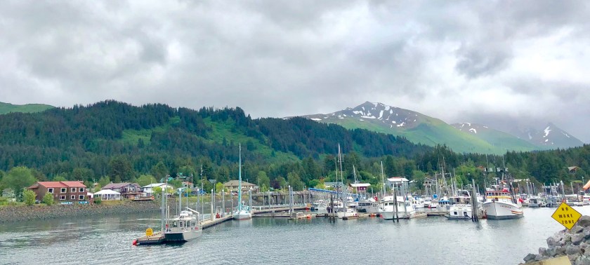


Author: vermontbuilder
Alaskan Coast
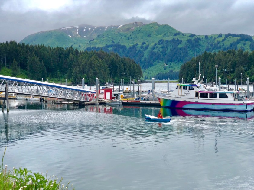
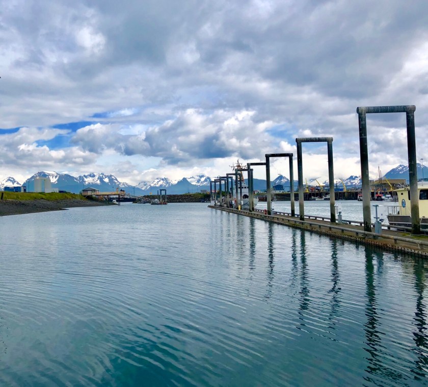
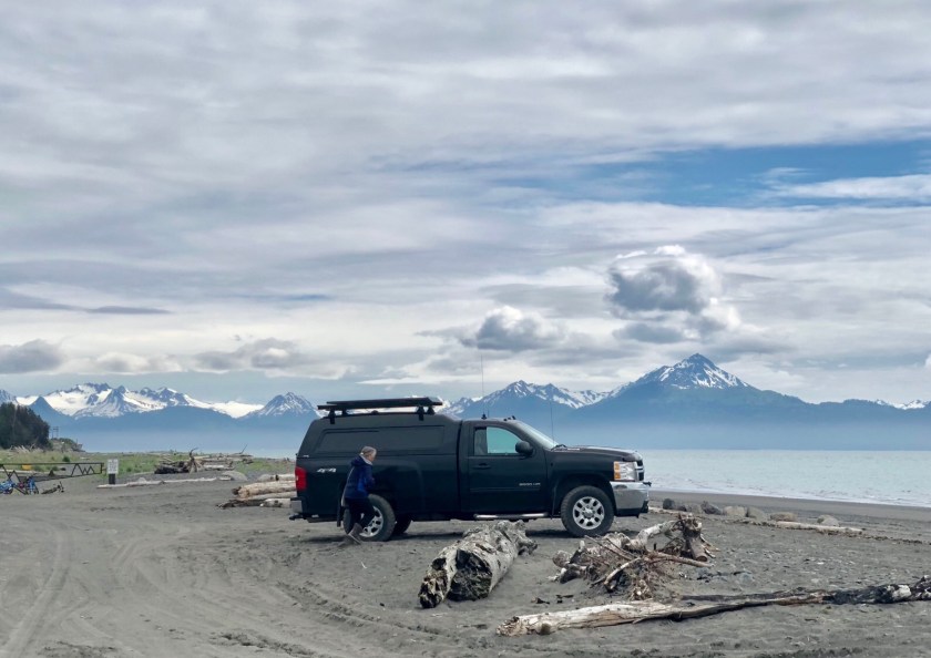
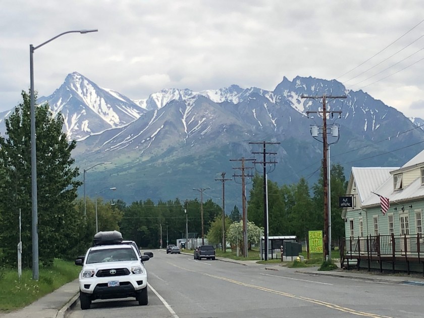
We drove 6 hours south of Anchorage, down the Kenai Peninsula, to Homer. This small fishing village has turned into a tourist Mecca during Alaska’s very brief summer. The stunning scenery of glacier covered mountains make for a beautiful backdrop for this end of the world location. This is the most beautiful harbor we’ve seen anywhere in the world.
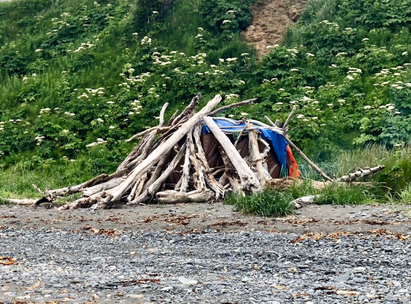
The local population is made up of old hippies, artists, and well tanned fishermen. I think this is the last place in America where you can camp free on the beach with no restrictions. One campers driftwood shack had smoke coming from a fire, he’d obviously been there for a while. You can also drive on the beach. Alaska has a live and let live attitude, there seem to be far fewer laws and regulations in general. You see pot smokers outside with the cigarette smokers, liquor and beer can be purchased to go at any saloon. RV travelers can pull over anywhere and sleep. There are no vehicle inspections. Lots of individual freedom.
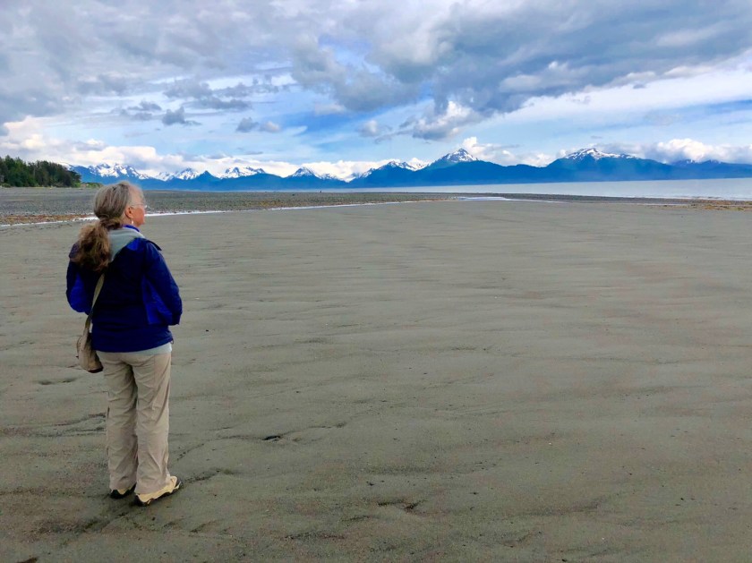
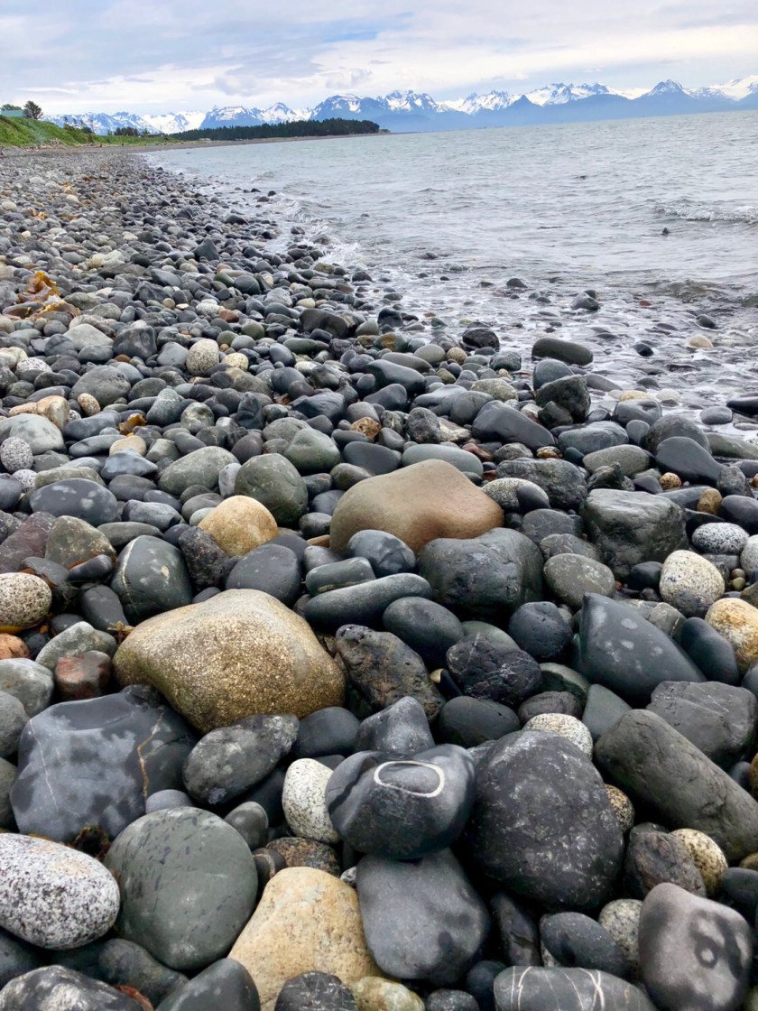
The ocean is surprisingly blue, almost a tropical color, and the freezing cold water is crystal clear. We walked for 2 miles up a beach and saw no trash whatsoever, nothing man made or discarded at all. We’ve never seen such a clean beach anywhere in the world, wow. Not only are the locals being conscientious, there was no ocean trash from distant civilization.
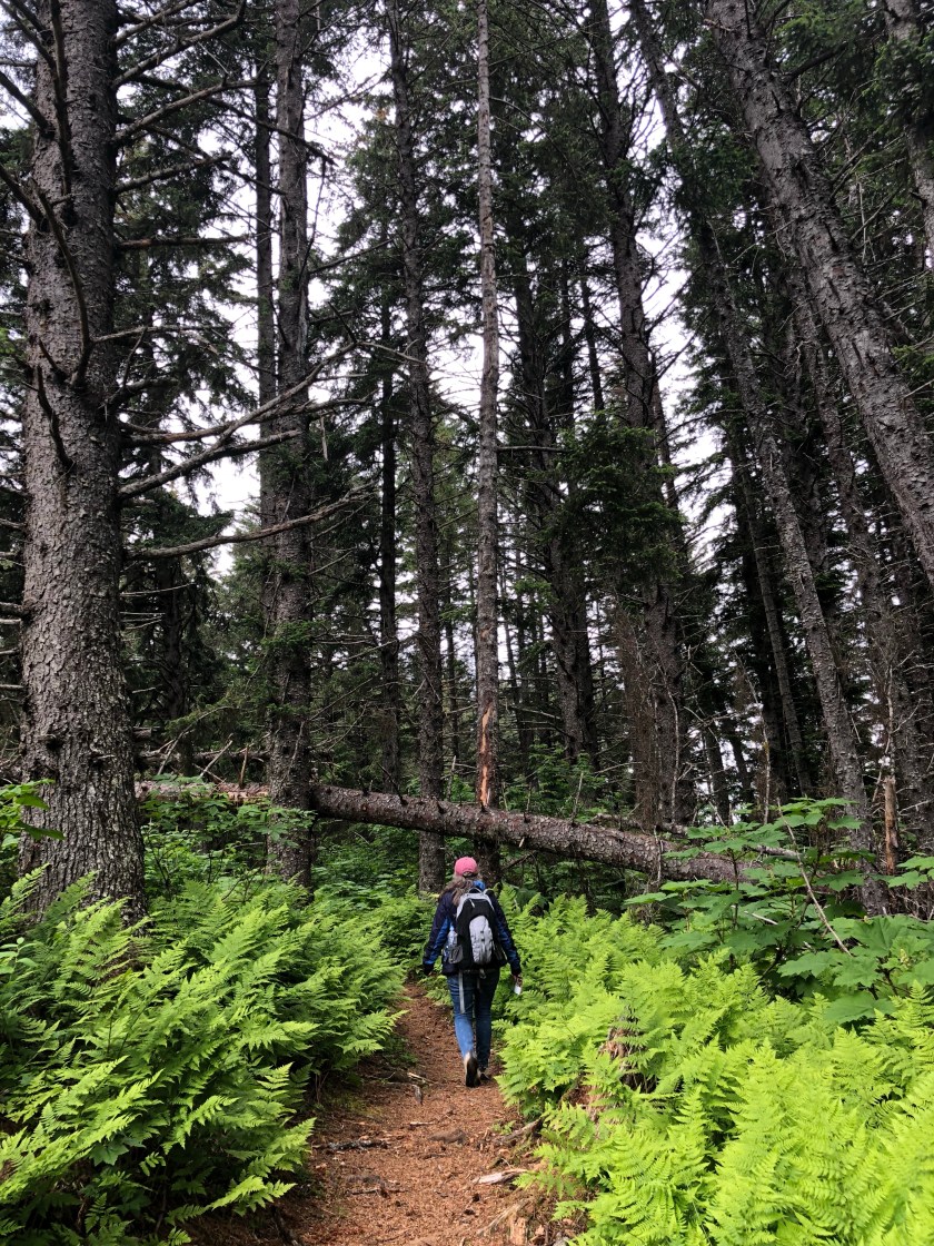
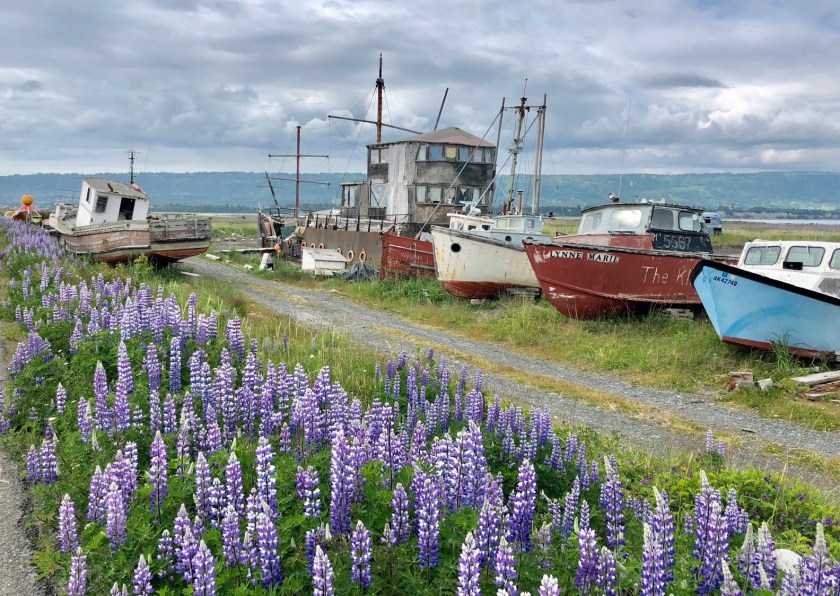
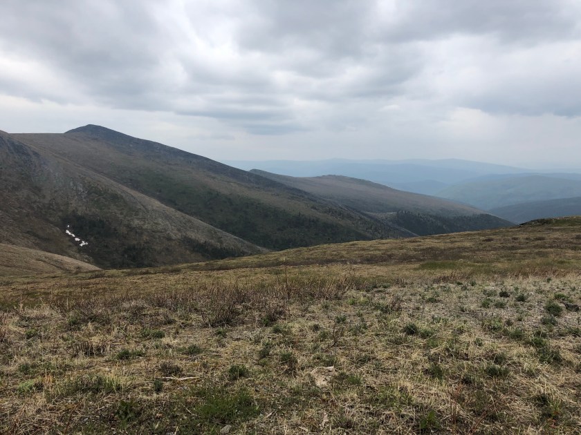
We took a ferry across a huge bay to Seldovia, a tiny fishing village ( population 255 ) . There are no roads to the outside world, you either fly in on a seaplane or come on a ferry, About half the population is Indians , who say they’ve occupied the area ” forever “. We spent the day hiking, very enjoyable. There were no Grizzly bears in the area.
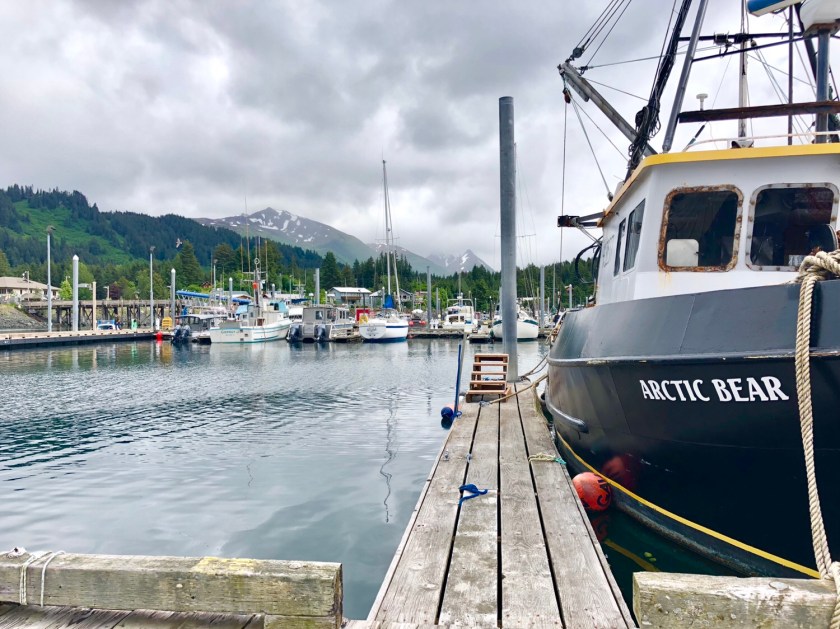
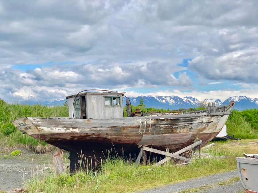
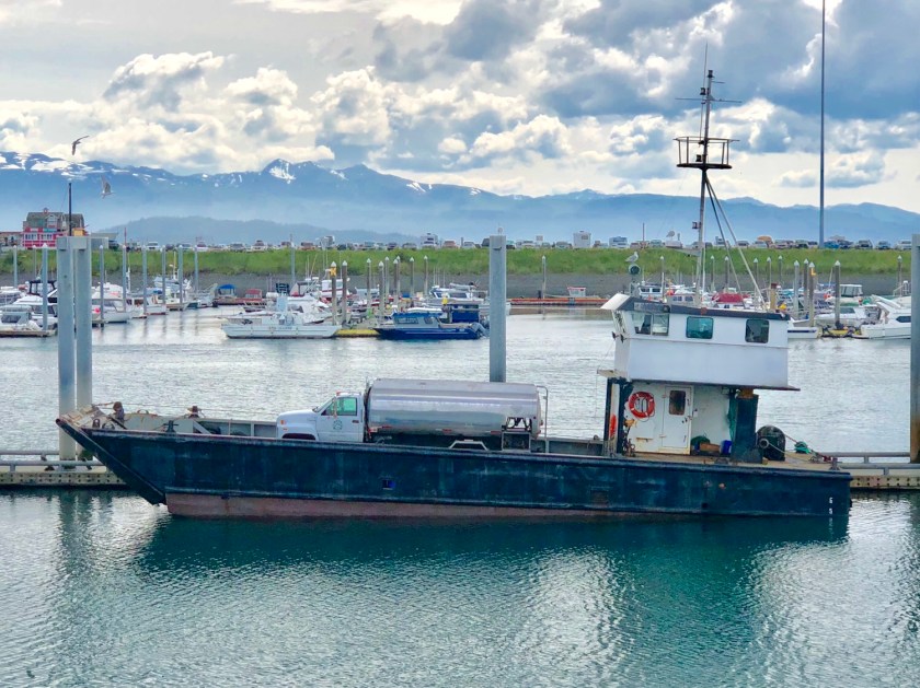
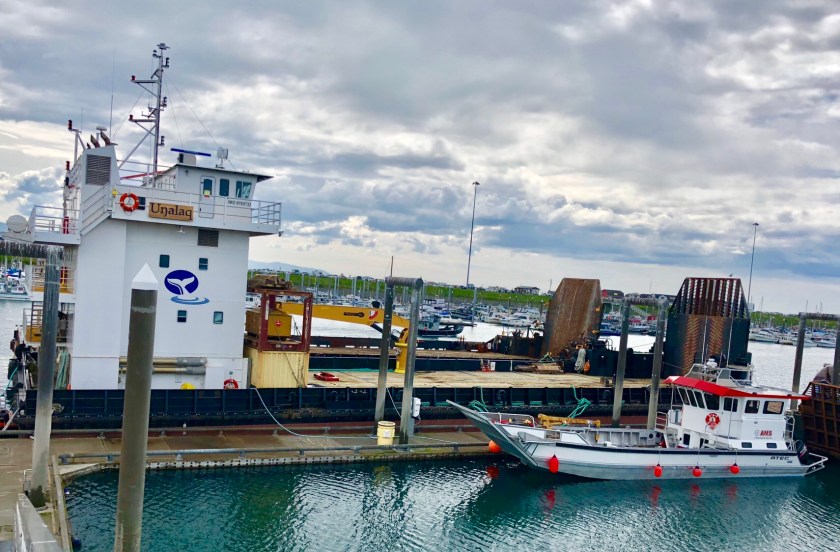
There are hundreds of isolated coastal villages like this. Supplies are only able to be brought in during the brief summer. Flat bottom barge like boats, with ramps capable of beach landing, bring in supplies, fuel trucks, containerized shipping etc. It was fascinating to walk around the harbor .
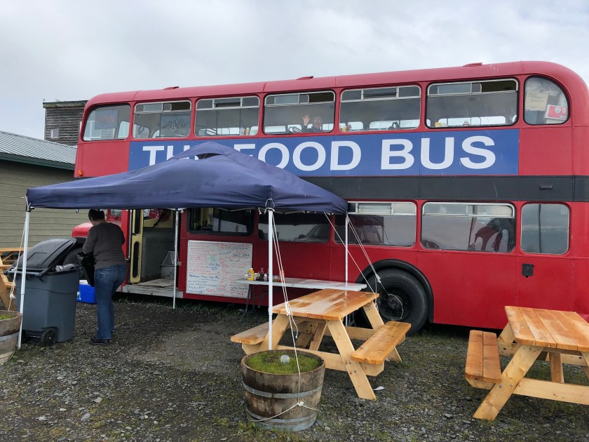
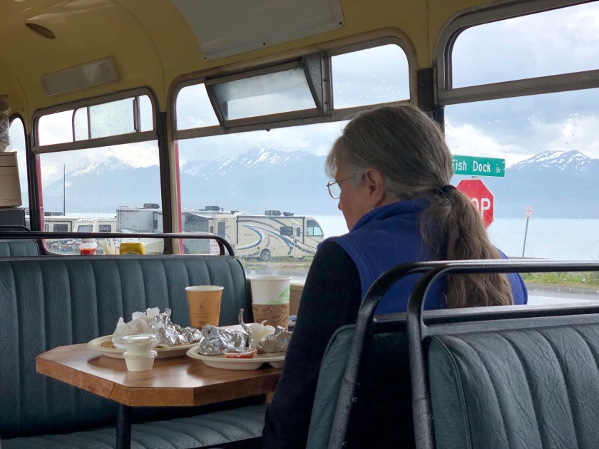
We found a place that rented nice little cabins with ocean and mountain views . We enjoyed the luxury of a full kitchen, dining out was super pricey. The local seafood was delicious. We spent almost a week here, it never got above 55. Sweaters sell better than t shirts ! 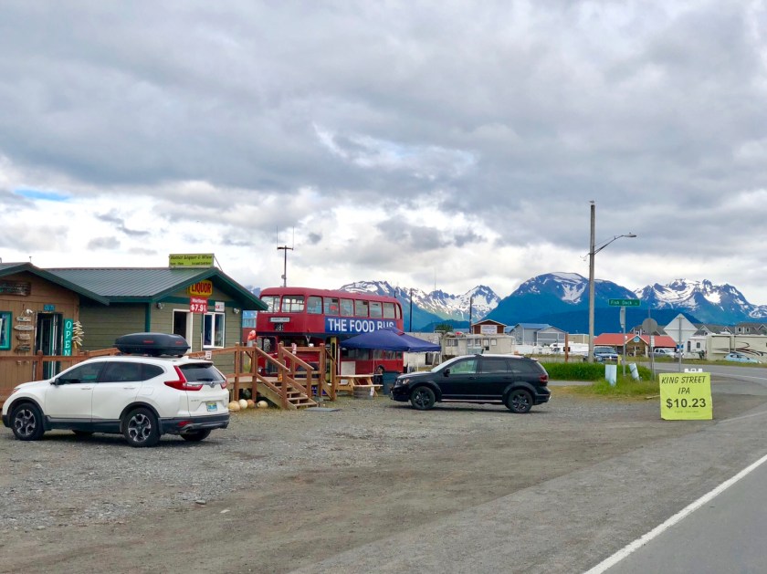


Alaska
I departed Dawson City on the free ferry across the Mighty Yukon. I exited on the far side onto a gravel lot with no buildings, just a dirt road leading uphill. This was the beginning of the Top of the World Highway to The Alaskan border a hundred miles away, The gravel road winds along the mountain tops mostly above tree line. There are no gas stations, no towns, just empty mountains to the horizon in all directions. The road had just opened 5 days earlier for the summer. After driving the road, I realized they should have waited another couple weeks. Much of the road was frozen , other areas had water sheeting across from melting 10 foot tall roadside snow drifts. The pot holes were legendary, hard to spot in the rain. It poured all day, raining sideways in the howling mountain winds. I stopped for a break and immediately had my hat blown off.
It finally turned to a drizzle as I approached the International Border. The crossing is located in the most unusual border crossing spot I’ve seen anywhere in the world . The shared Canadian American building straddles a mountain top way above tree line. I was greeted by an American Border Patrol agent who commented on my Vermont plates. He wants to take a similar trip some day ( I often hear that ). I set my watch back one hour.
The drive down out of the mountains into Alaska took several more hours. I finally arrived in Tok, Alaska, a small town on the Alcan Highway. Whew, I’ve driven over 14,000 miles to get here. I enjoyed a wild salmon dinner. 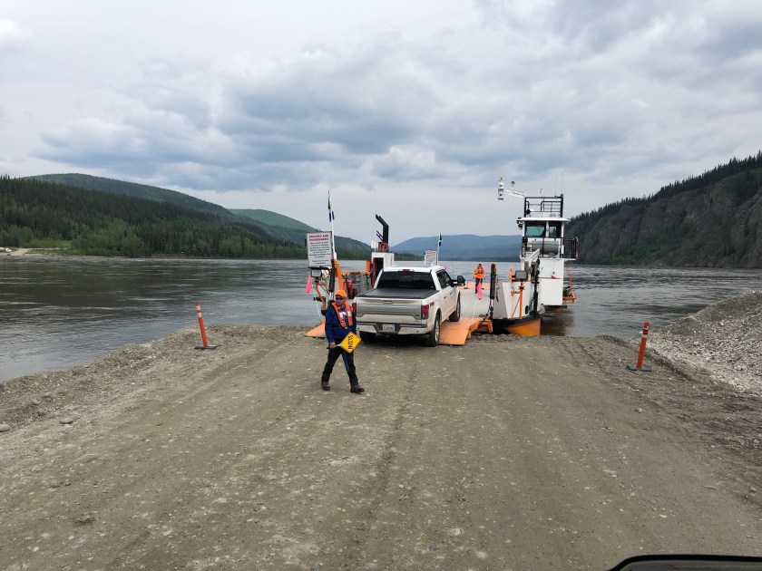


The Artic
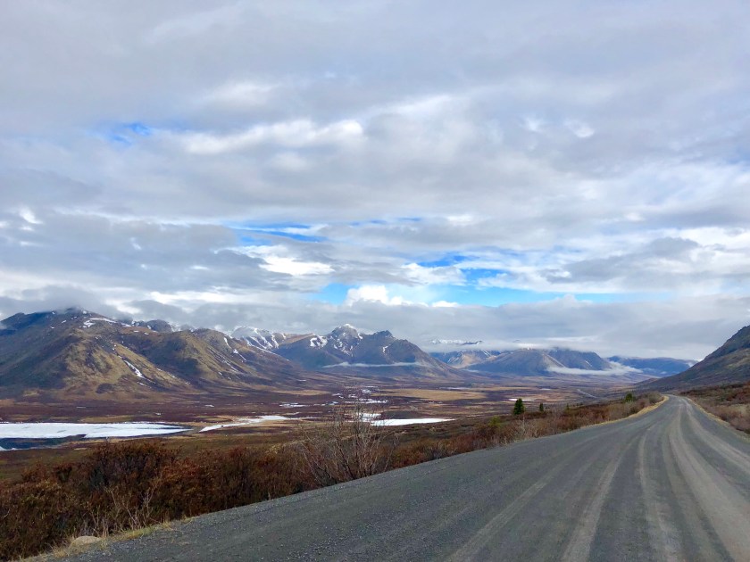
After reaching Dawson City, I decided on another side trip, this time up the Dempster Highway, a recently completed 450 mile gravel road that ends at an Inuit village on the Arctic Sea. The road crosses the Arctic Circle about half way up it’s length. I had visited the First Nation ( Inuit ) Visitors center in Dawson City, The polite Inuit Natives encouraged me to head north to visit ( and spend money) at their seaside village at the end of the road. After all the dirt roads I’ve traveled on, I couldn’t face the almost 1000 miles round trip on it. I decided to fill up with gas in Dawson City and drive as far north as I could prudently go and still make it back on one tank of gas, my truck will go 400 miles plus on a tank so I decided I’d drive 150 miles north and camp.
I had camped the night before the drive just below the final mountain pass into the Arctic. This subalpine zone is referred to as the Tiaga, the ecosystem where the trees start to thin out and give way to Arctic Tundra. The Inuit ladies in Dawson had warned me snow was predicted in those final mountains. I waited till the next morning to head out. This range is the last of the Rocky Mountains I started following north in Southern Arizona three months ago. I had reached the Northern most tip of this 5000 mile long string of peaks.
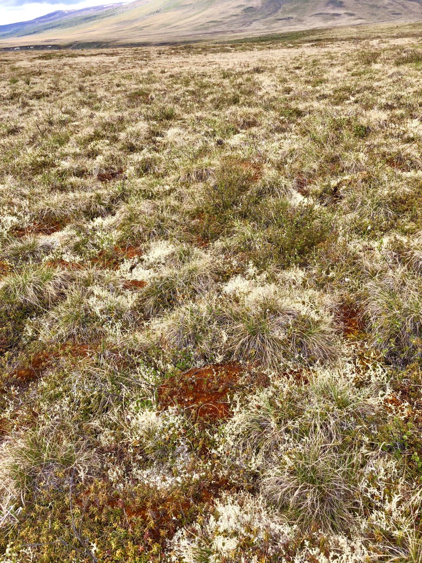
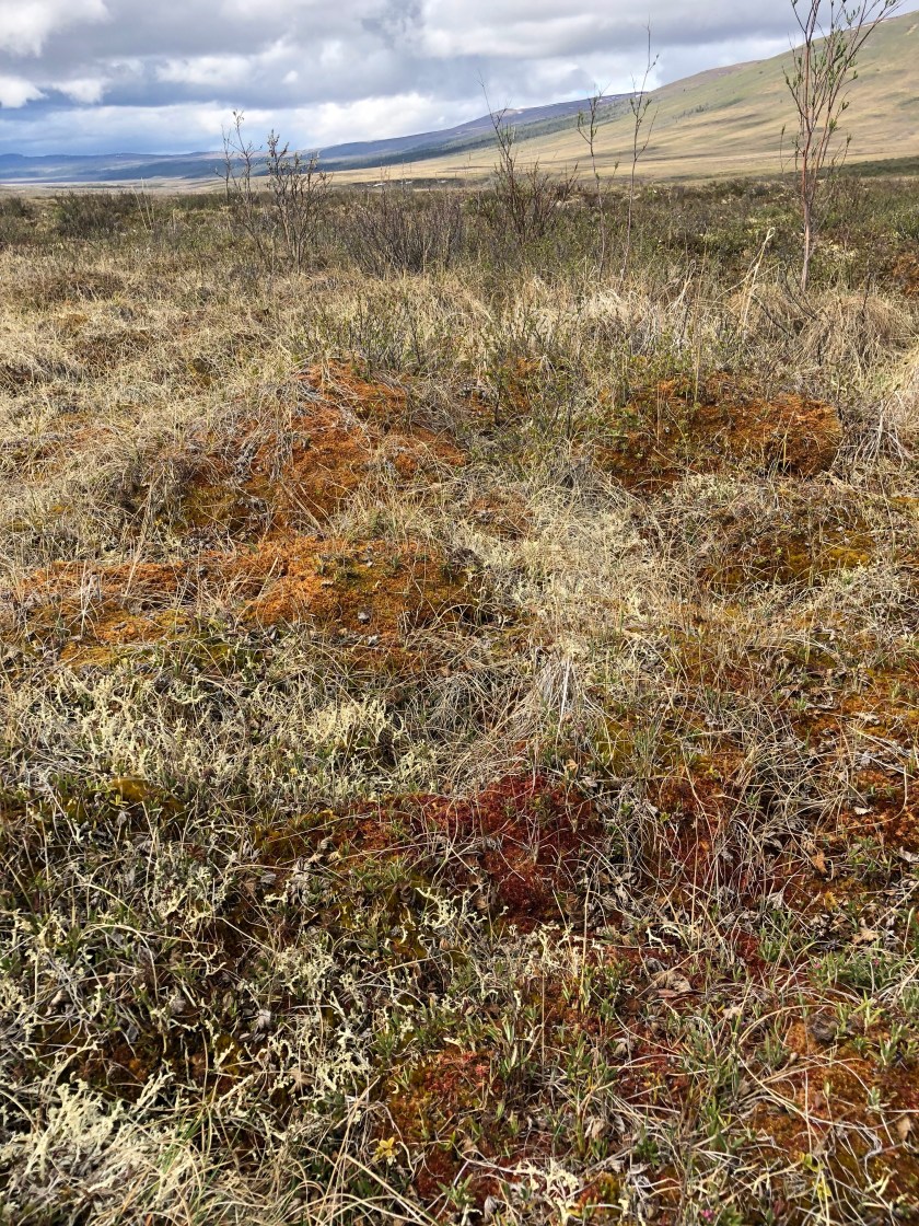
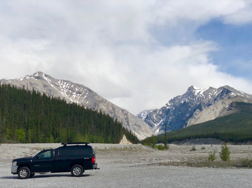
There is only one gas station about 300 miles up the road, and other than that , there’s nothing on the road but endless wilderness. I climbed the mountain pass, leaving the last trees behind. With towering snow capped peaks on either side, I slowly descended out onto what is called the North Slope, all rivers here drain into the distant Arctic Ocean . Except for some taller brush along water ways, the ground here is all Tundra, moss and tiny plants no more than 12 inches high. The Tundra stretches to the horizon in all directions, the only voids are on the higher slopes and mountain tops where bare rock prevails. I was in the Arctic.
I camped by a rushing glacial fed river close to the road. Although I carry my own drinking water, camping by a river provides access for washing, etc. Normally I avoid camping near a road, but in this case, the sound of that one vehicle every hour or two was a comforting sound of fellow humans in this vast wilderness.
I went for a hike the first morning, ( the sun never dropped below the horizon at night, it never got dark ). I wandered 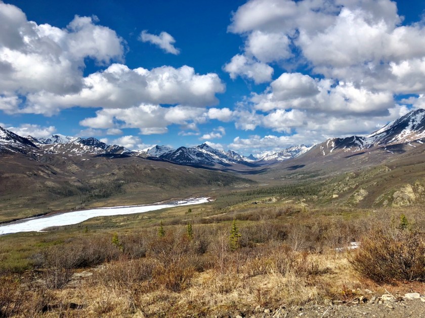


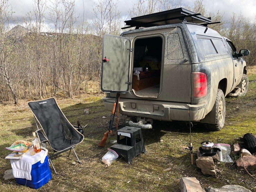 miles out into the open Tundra. This is the area where spring and fall brings mass Caribou migrations with thousands of animals passing thru. I had missed the spring migrations so I had the endless plains to myself. The occasional ponds were full of nesting ducks and even waders like Plovers . These North Slope uplands are considered prime Grizzly Bear habitat, big game hunters from all over the world come here for the fall hunt. I had discovered bear sign near my campsite so I knew they were around. I figured they couldn’t sneak up on me out on the open Tundra.
The Tundra was surprisingly hard to walk on, what looks like smooth solid ground is actually soft , spongey and often wet . Because of the permafrost just below the surface, water can’t drain away, resulting in a sort of continuous swampy ground. About every 10 paces I would sink into ankle deep hidden puddles . Fortunately I had my rubber boots on.
The Blackstone River was full of fish. On my third cast I caught a nice Arctic Grayling. I subsequently caught several more, These Graylings are renowned for their good eating, unfortunately I didn’t dare clean and cook fish at my campsite, that would surely attract bears. I’d been warned by a Game Warden that a Grizzly can get in a locked truck , so to be on the safe side, all fish were released back into the river. So much for a nice fish dinner.
One of my goals for this cross country journey was to reach the arctic, this side trip fulfilled that dream. I have to say that this was one of the highlights of the my long journey.
Dawson City
I decided to take a side trip up into the Klondike, a scenic part of the Northern Yukon Territory . I headed due north off the Alcan Highway towards Dawson City, the location of the huge gold rush of 1897. The drive up the Klondike Highway was breathtaking, the wilderness went on and on. The temperature dropped as I headed north, nights were getting into the 20’s with days in the 40’s.
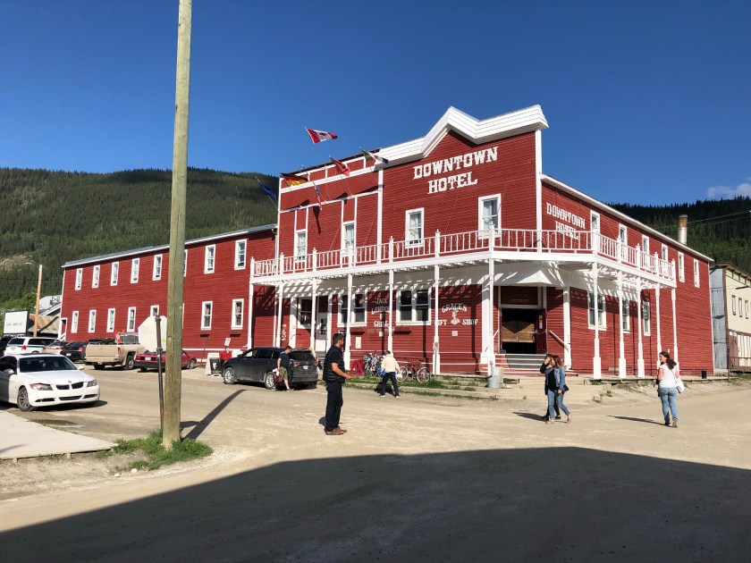
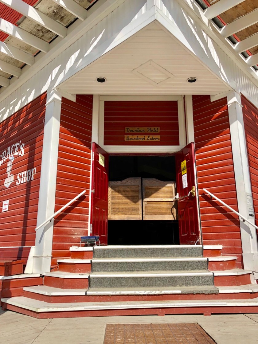
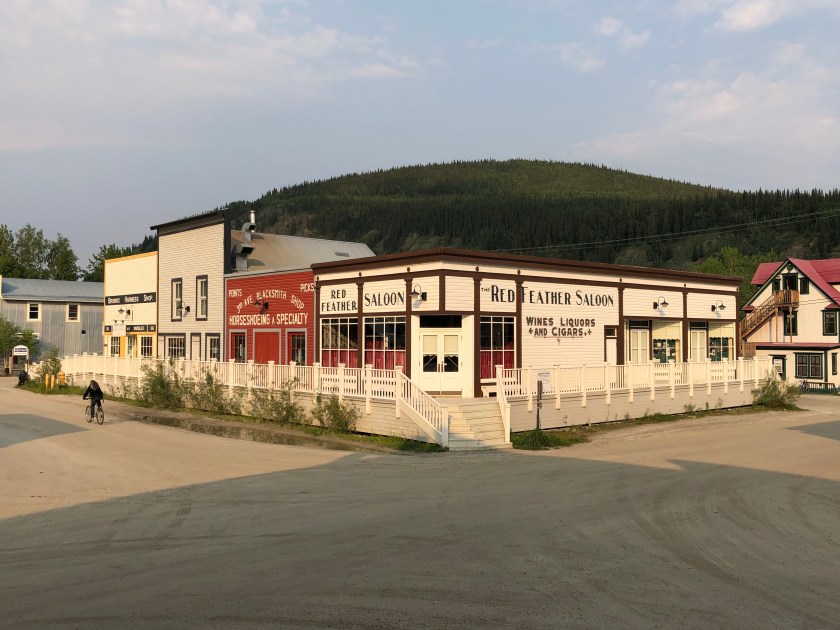
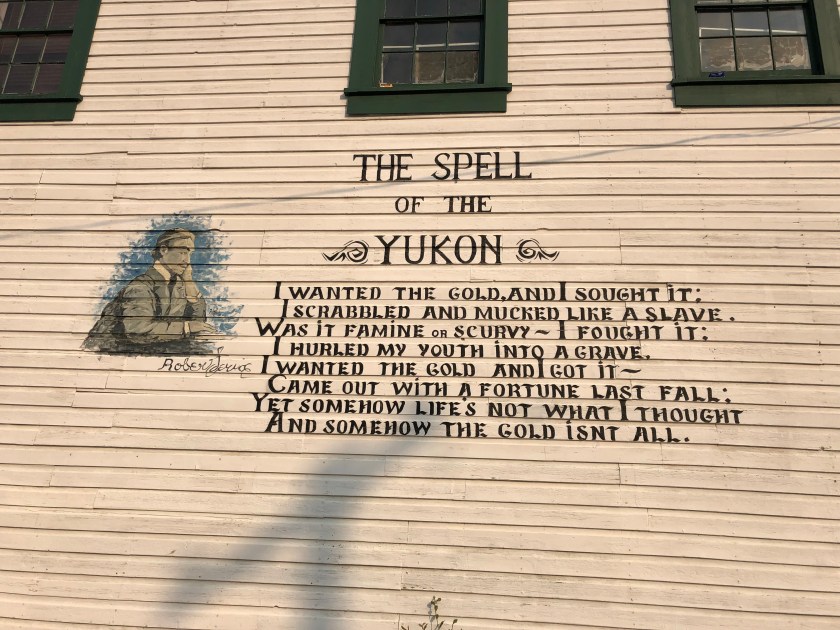
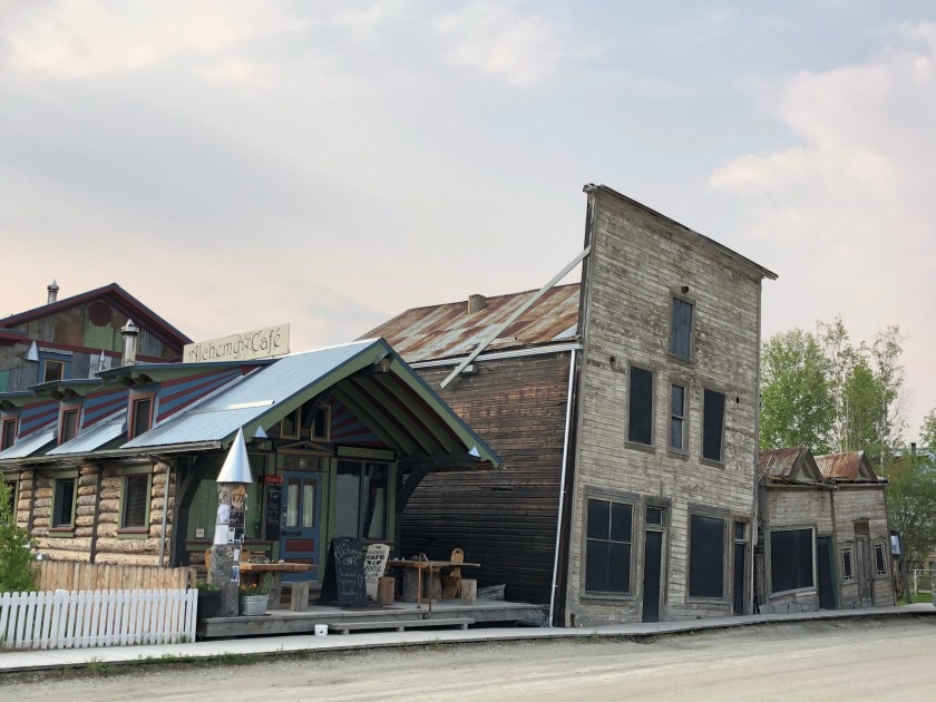
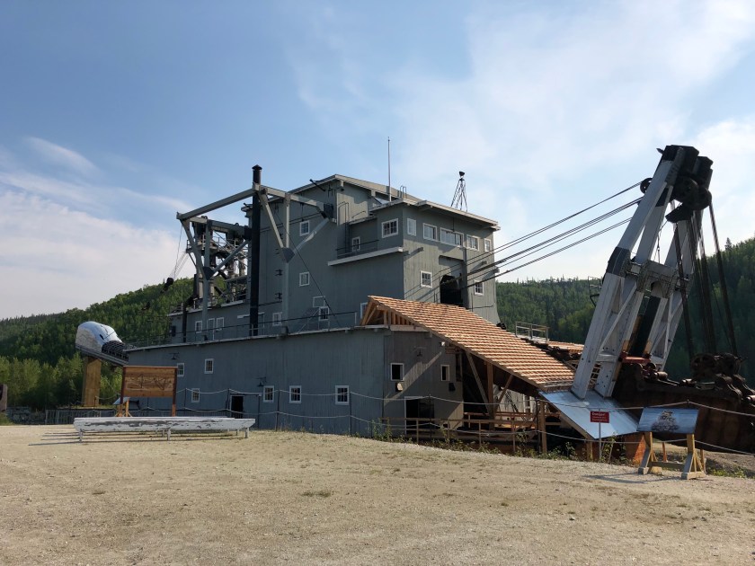
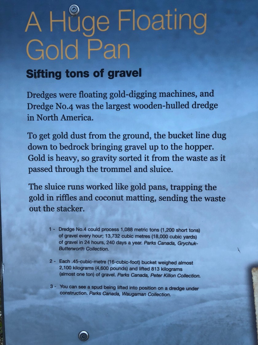
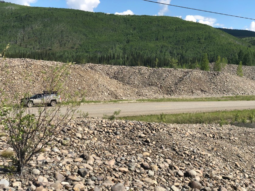
The Klondike gold rush was brief but huge. Dawson City became a thriving small city almost overnight. Miners poured in from all over the world. Dozens of hotels were built as were saloons, stores, whore houses, etc. Within 4 years, the “easy” gold was gone and the crowds disappeared. Investors and industrial mining took over using huge floating dredges that processed the gravel river beds. This was long before mine reclamation was required resulting in profound and total destruction of every river and stream bed within 20 miles. The roads are now lined with miles of mining waste, the waterways destroyed forever.
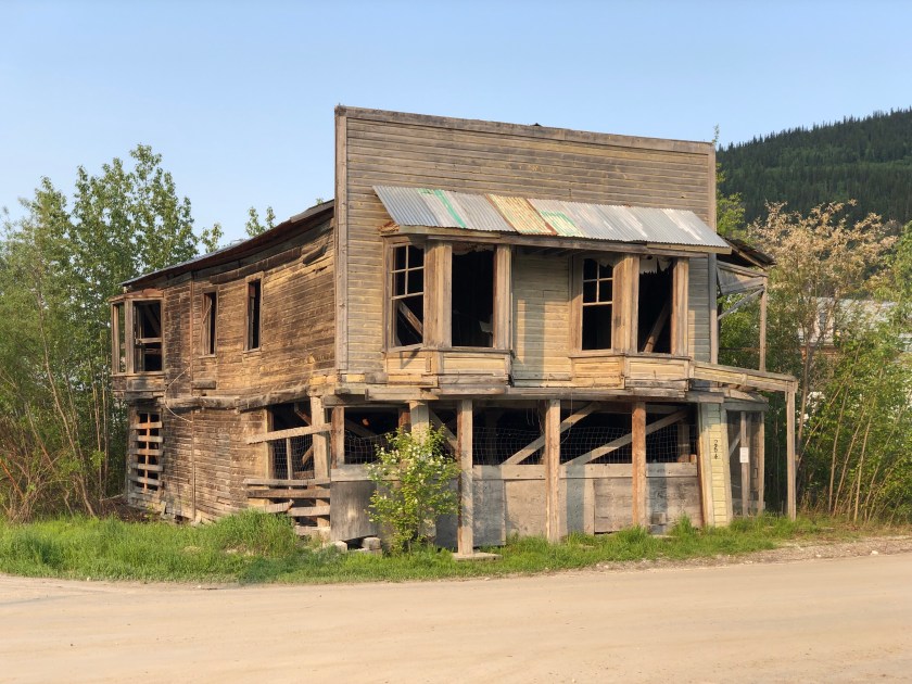
The city itself is a time capsule of late 19th century frontier architecture. Many buildings have been beautifully restored, many more are awaiting work. The mix of restoration and decay is fascinating, the wood sidewalks add a nice touch to the dirt streets, only main street is paved. Although at the end of the line, tourists are flocking here. Buses from cruise lines bring people in from the distant coast. The airport ( dirt runway ) has flights from Vancouver. 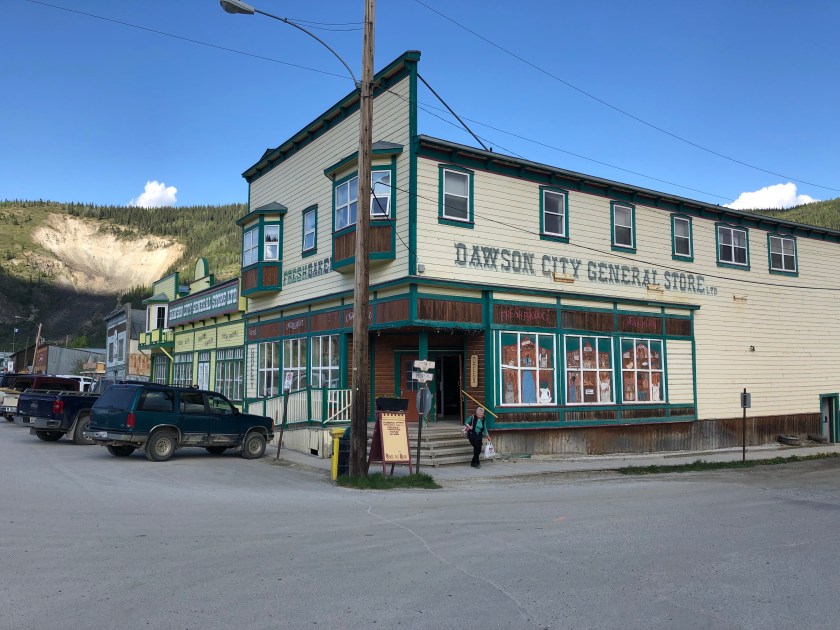


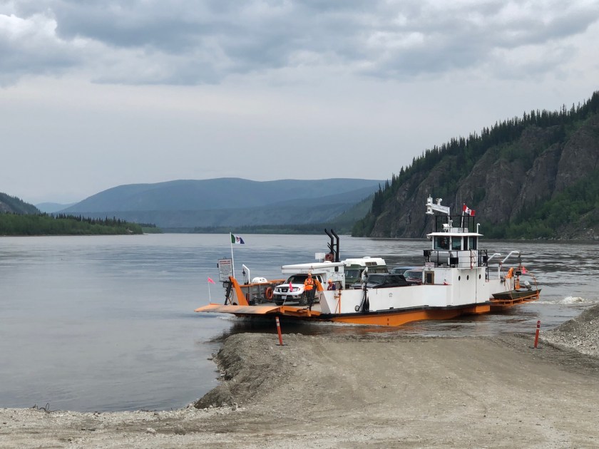
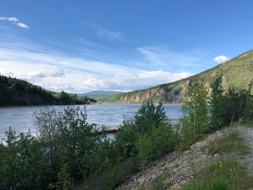
I departed Dawson City on the ferry boat that crosses the Mighty Yukon. My next destination was the Alaskan border over a 100 miles away on a gravel road through the wilderness. The ferry ride was free, provided by the Yukon Government.
Alcan Highway
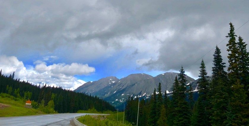
The Alaska Highway starts in Dawson Creek , British Columbia. It’s 1459 miles to the end in Alaska. They claim the road is “paved” but the term is loosely used. The pavement is really just oil sprayed on gravel with a top coat of more gravel. The perma frost makes road maintenance a night mare. The result is often some smooth highway, some rough sections and some really nasty areas. The speed limit is 65 with many drivers doing 80. 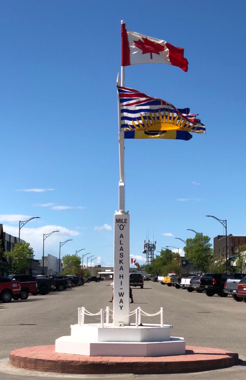


Wildlife is a constant worry, hitting one of the wild beasts will end their lives and my vacation. Early morning is the real danger time .
The driver quickly learns to very carefully watch the road ahead, occasional monstrous potholes appear suddenly, a direct hit can loosen your teeth.
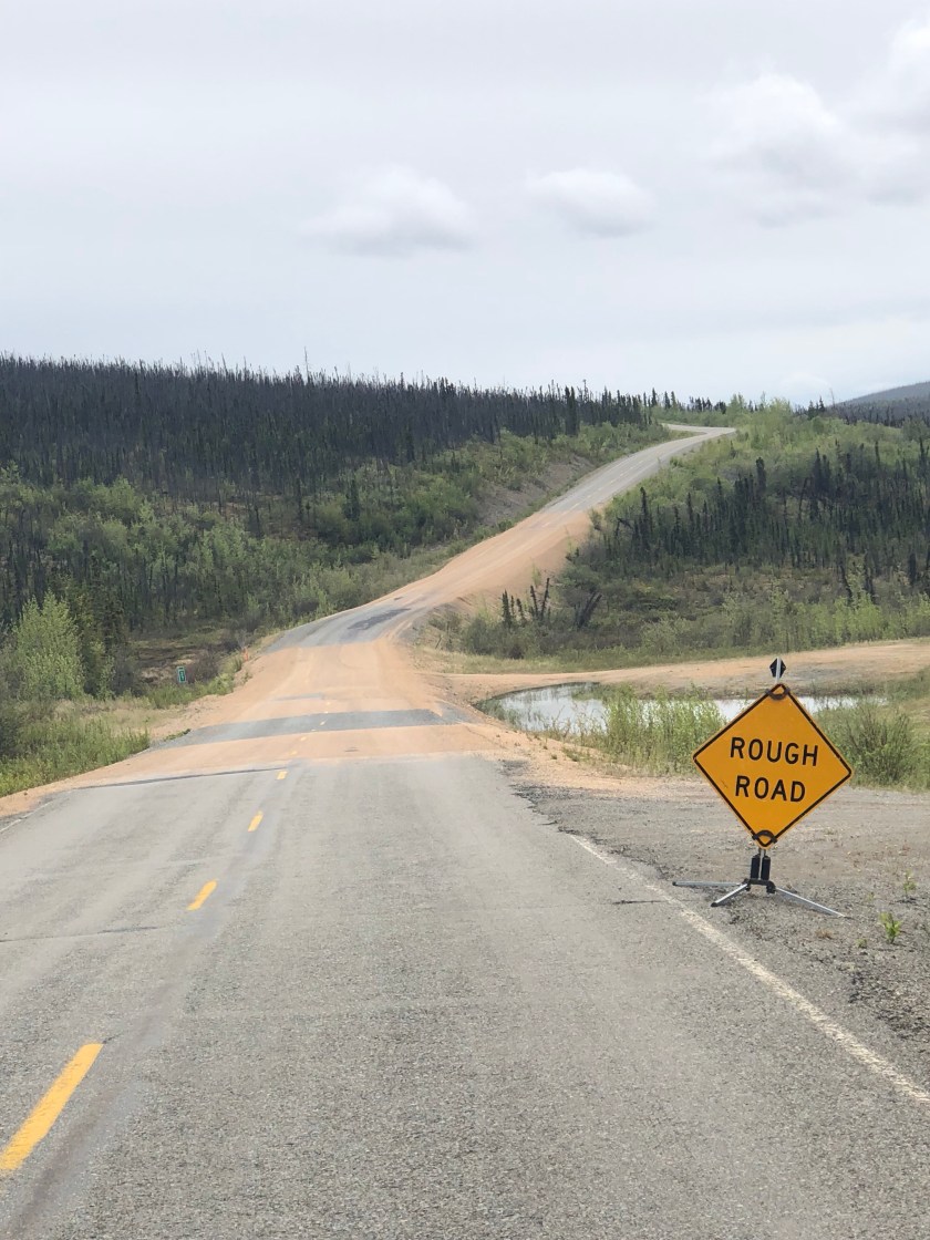
After the first bone rattling strike, I carefully scanned the road ahead constantly looking for trouble. The signage was a bit baffling at first but the subtle way they warned of danger became apparent:
The rough road icon signs means REALLY rough pavement ahead, usually across both lanes. This sign requires quick braking.
The rough road sign spelled out is a notch above the icon sign, this warning requires slowing WAY down as road ahead is unusually rough and loosing control is possible.
The Road Damage sign indicates the pavement ahead is either severely damaged or non existent, time to slow to 10 MPH.
Another sign to be noted was the DIP AHEAD. I ignored this sign the first time as the “pavement ” looked unbroken and smooth. I suddenly dropped 2 feet into a “DIP” and after 30 yards hit the up ramp, launching the truck airborne and semi out of control, a frightening experience.
So much for sight seeing, gotta watch the road !
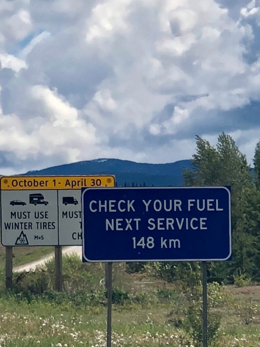
The distances between fuel stops can be huge, it behoves the driver to carefully monitor fuel levels, 1/2 tank means start looking for a gas station. The more remote the gas station, the higher the cost. I paid $7.45 a gallon at one place. There are usually warning signs giving drivers a heads up to gas availability ahead. Those who don’t pay attention can be in serious trouble. I stopped at a remote intersection to do a map check ( very few intersections) . While engrossed with my map, I was startled by a voice at my window. A clearly distraught women ( who spoke very poor English) was babbling about being g out of gas. She asked which way I came from and how far was a gas station . She was horrified at my answer , 75 miles . She apparently had not gassed up when she departed up north ( 85 miles). She ( and her husband) now didn’t have fuel to make it back or south to gas. She pleaded with me for some gas which I had none to offer. She walked away mumbling, clearly on the verge of tears. This is not a place to wing it, traffic is almost nonexistent and I NEVER saw a cop etc. I can’t help but wonder how they made out.
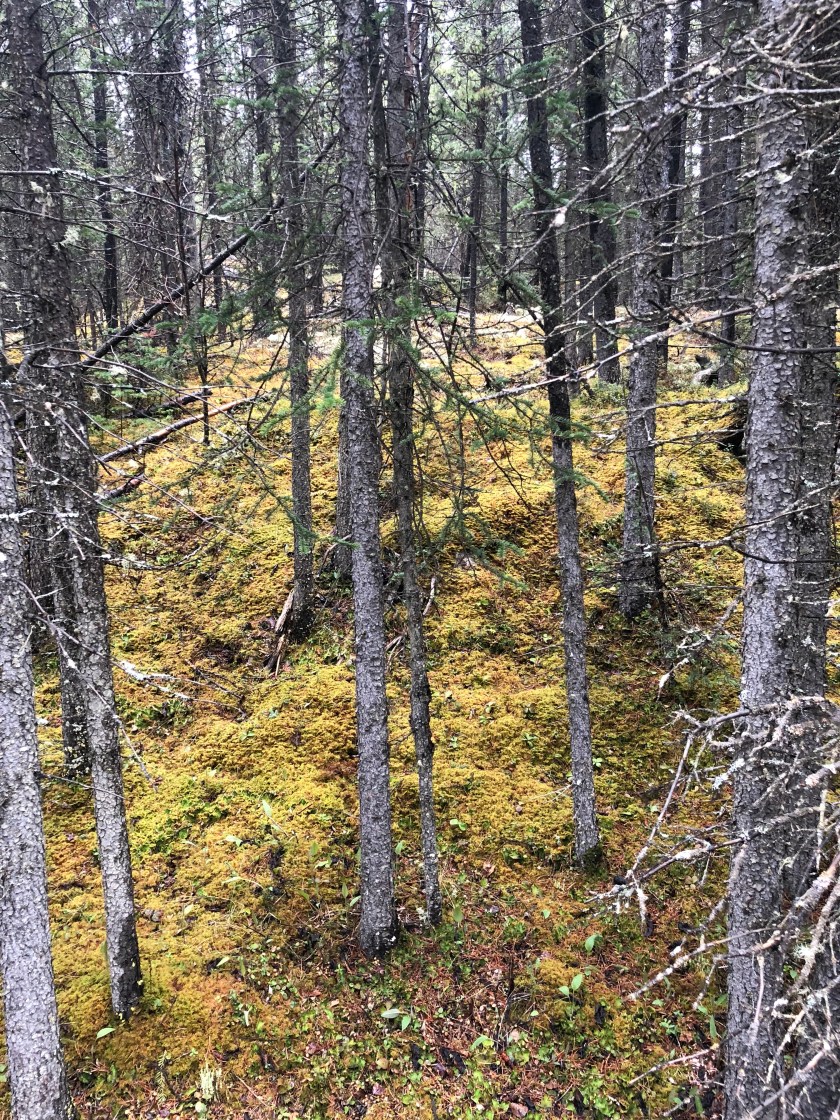
Boreal Forests
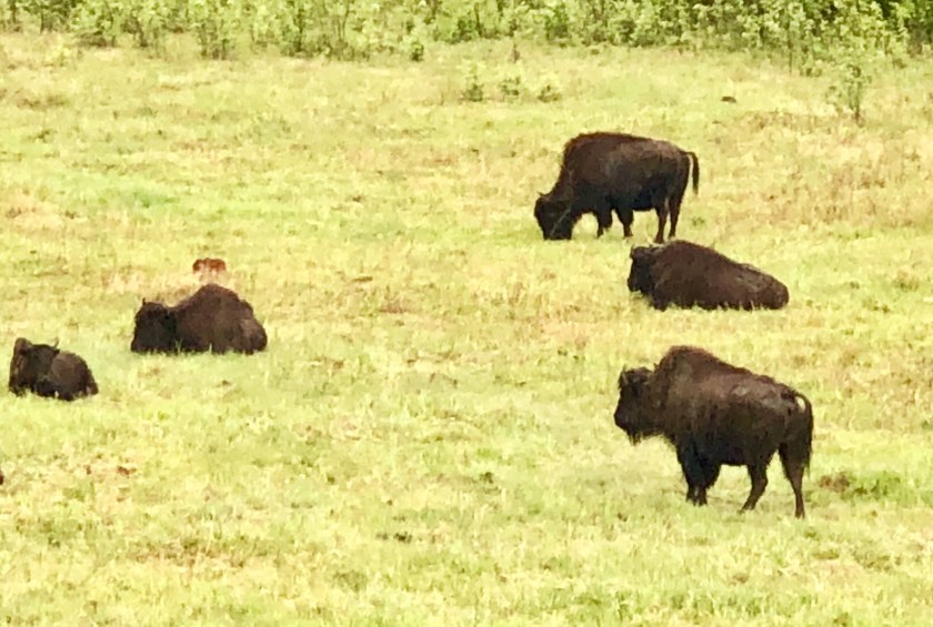
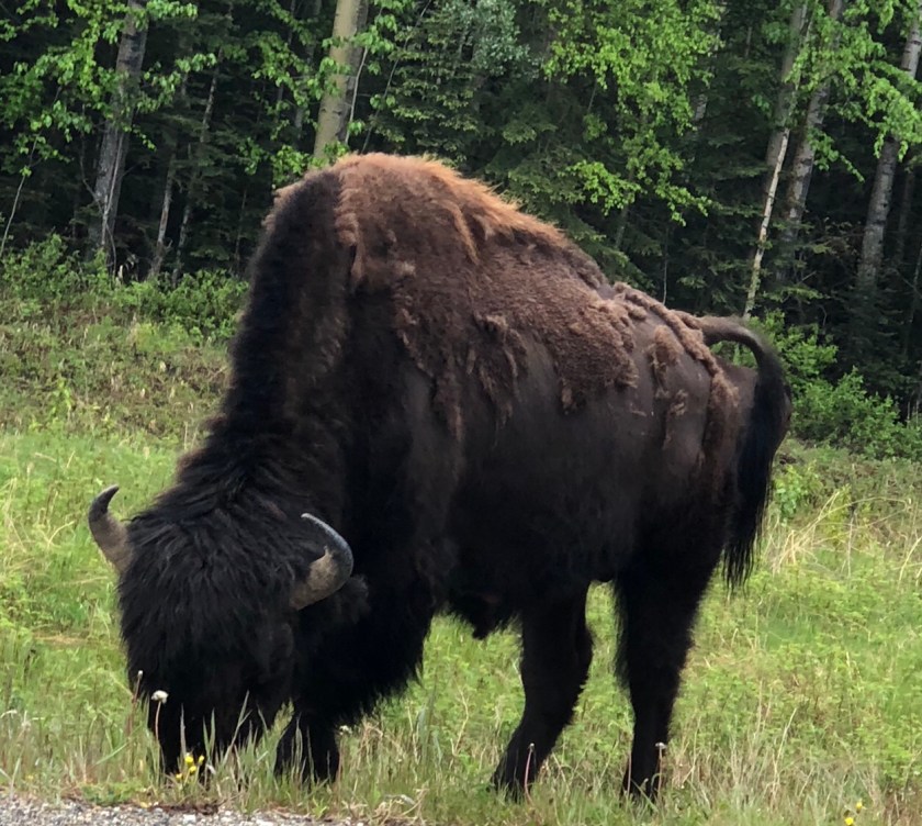
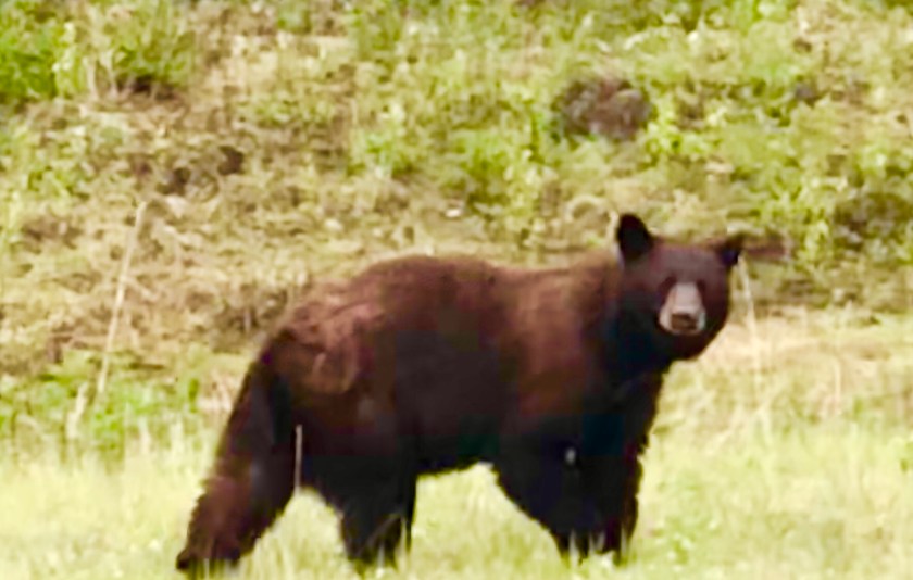
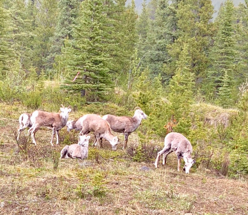
The vast unbroken Boreal Forests stretch to the horizon for hundreds of miles in all directions, it’s one of the last untouched northern forests in the world, true wilderness. The forests begin in British Columbia and continue up into the Yukon Territory to the treeless Tundra of the North. The arctic weather prevents the tree from getting much bigger than a 12″ diameter . The forest floor is pure,soft moss, sprinkled with lichen, a beautiful palette. These stunted dense forests abound in wildlife, On any given day, I will see Caribou, woodland Bison, bear, Big Horn Sheep plus numerous smaller creatures, including Arctic Fox, otter, porcupine, etc. The Caribou is a big animal, the cow I almost hit was the size of a moose.
The large animals ( bear, bison….) seem oddly perplexed by my presence, they don’t seem to recognize me as a threat, only an oddity, they show no fear. I’m so used to animals running at the sight of me in Vermont, it’s odd to see them stand their ground and gazing at me. The brazen bears are a bit scary, not sure what they will do.
There is next to no traffic on the Alaska Highway, I will see perhaps a half dozen cars go by per hour. This allows me to stop in the middle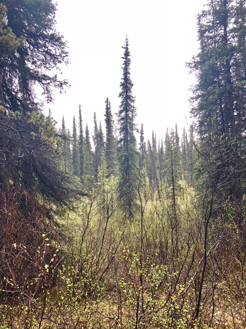

British Columbia
Like so much of the far West, distances are vast in Western Canada. After crossing the Border, it took me 3 days to reach Dawson Creek British Columbia. There are huge empty stretches of Wilderness ( 100 miles across ) between the various cities that are strung up the central part of the Province. I passed hundreds of tractor trailers loaded with sawed lumber heading South.
Midway, I stayed with the local Fire Chief at his Airbnb, his remote house was several miles off the main highway . He was a gardener and mentioned that they get a killing frost 12 months a year ! The great fear many of these Northern dwellers is forest fire, they are plagued with occasional raging fires. Vast burned areas scar the forested landscape.
Traveling North, the productive pine forests slowly give way to the scrubby Boreal Forrest. This is the final forest type as you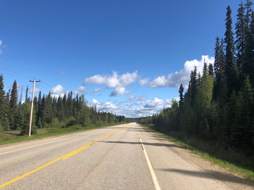


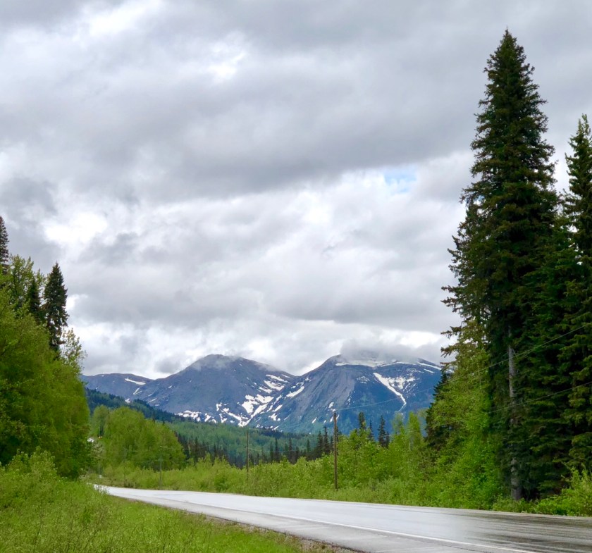 approach the vast treeless Tundra further North. These endless forests are dotted with pristine lakes, void of cabins or any sign of man, probably the way Maine looked 300 years ago. This is Grizzly country, seldom seen but to be respected.
Prices are very high here, almost $6.00 per gallon gas, food is double too, not sure how the locals make it. I’ve arrived up North early, very few tourists, the way I like it. Alaska here I come!
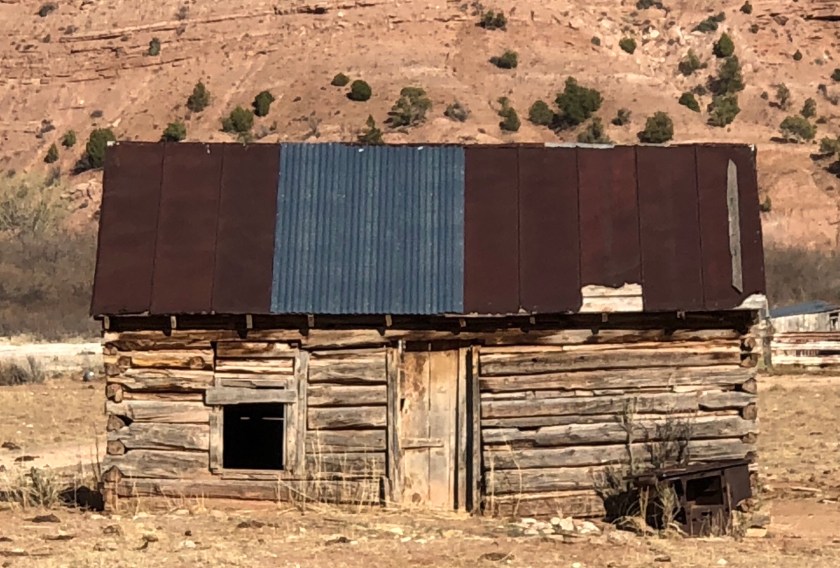
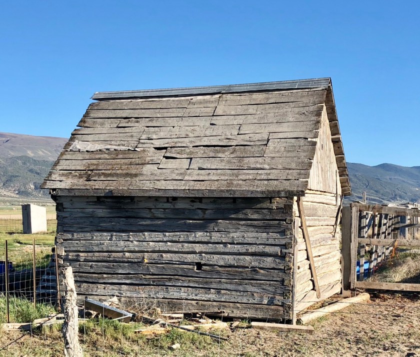
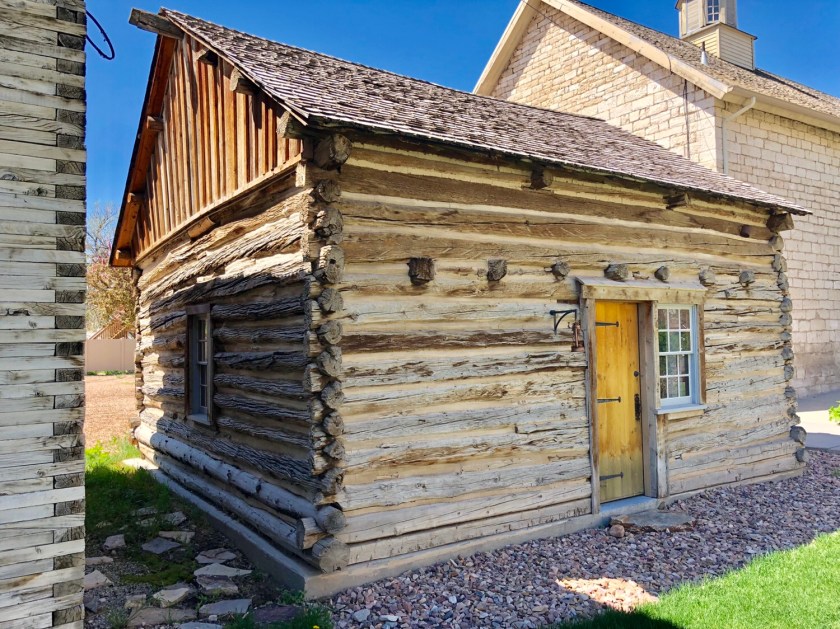
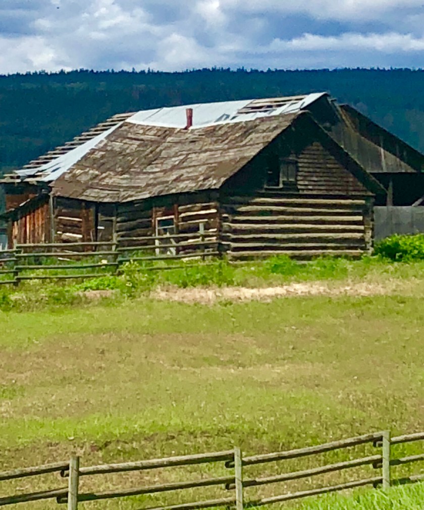
Pioneer Cabins
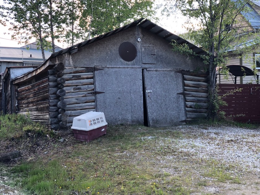
Traveling north through the Rocky Mountains, I started to see these old cabins in Southern Utah, where the Ponderosa pine grew tall and straight. These relicts of our pioneer past are sprinkled throughout the West and remarkably, they are often still occupied. In the dry desert climate of Southern Utah, they are often in remarkably good shape even without a proper roof. They are typically one room usually smaller than a two car garage. They are often accompanied by log barns. The oldest cabins probably date to around 1850 while the later ones seen further up North could be around 1900. Like so much of our past, these Pioneers relics will probably slowly disappear, today they are living reminders of the toughness of those first settlers . 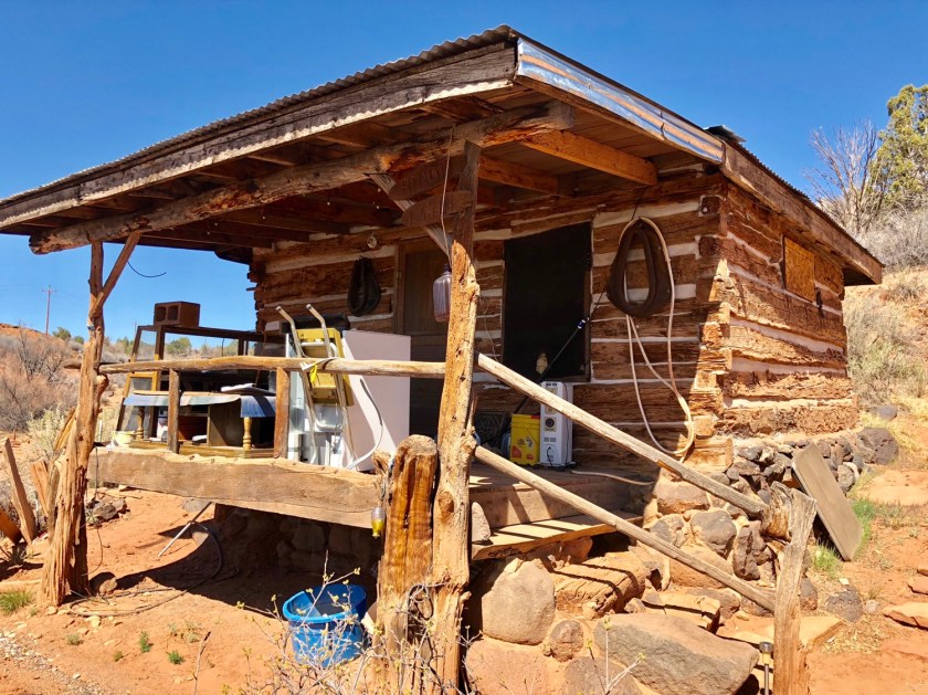


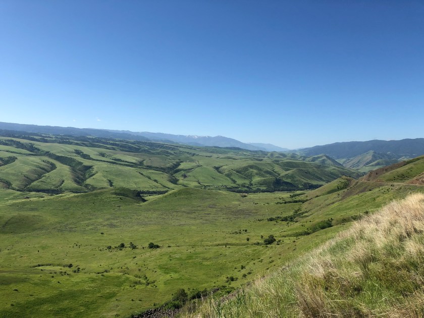
Nez Perce
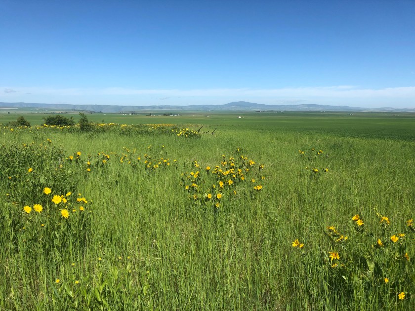
Having wandered much of the Western US, I’ve seen a lot of Indian Reservations and most of them have made me cringe. We have corralled these Original Americans into some of the most desolate, barren, worthless land in the West. No so the Nez Perce. This tribe has lived in the Northern Idaho, Western Washington lands for thousands of years and traditionally lived well off the game rich hills and Salmon filled rivers. Around the time of our Civil War, the Nez Perce were herded into a vast Reservation compassing some of their ancestral lands . These lands were guaranteed theirs forever by the US Government. A short time later gold was discovered on the Nez Perce land, and the White Man called the Treaty null and void . After bloody wars and further White encroachment, the Nez Perce ended up with 12% of their original land.
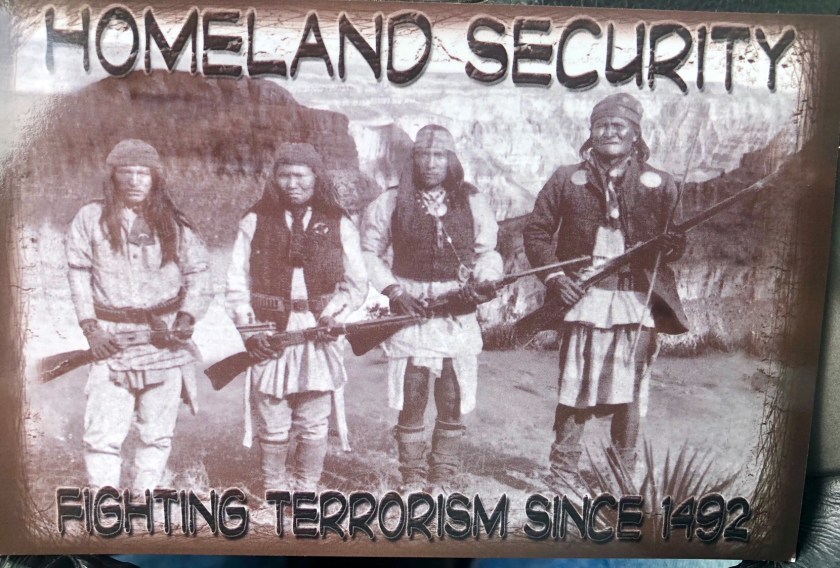
That being said, the Tribe has ended up with prime farm land and abundant game and Salmon on their ” Res “. It’s the most productive, beautiful Indian Reservation I’ve seen in America. While driving through, I stopped at a gas station and saw this Homeland Security post card, obviously tongue in cheek but still poignant. The firearms warning was at a Tribal controlled rest area. ( 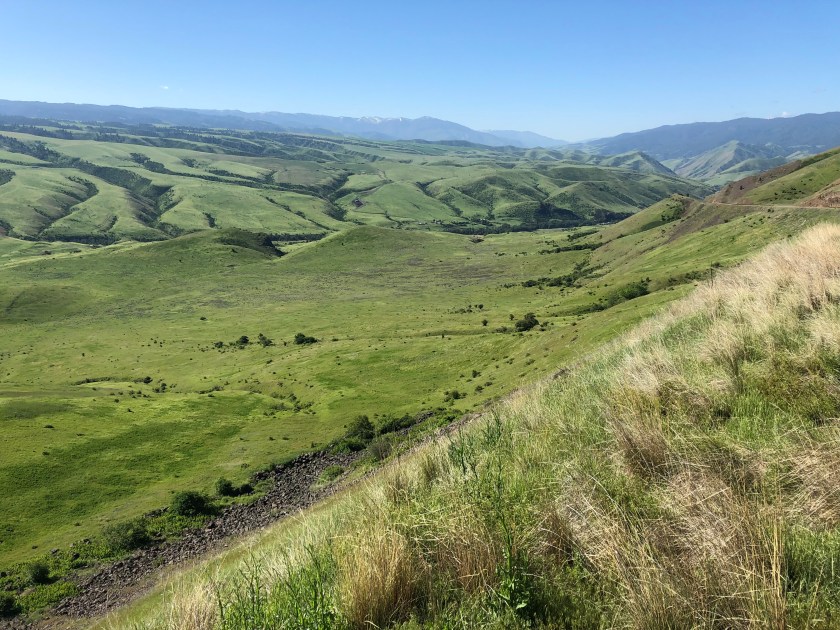

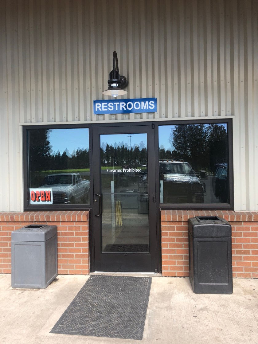
 for Tribe members? local red necks? not sure. I can hardly blame them for any ill feelings towards White Man.
